
Geospatial Data Solutions
Harness the power of Geospatial Data Solutions to drive efficiency, sustainability, and resilience in your organization. By integrating location intelligence, you can make smarter decisions, optimize operations, and achieve sustainable growth while fostering deeper connections between industries and communities worldwide.
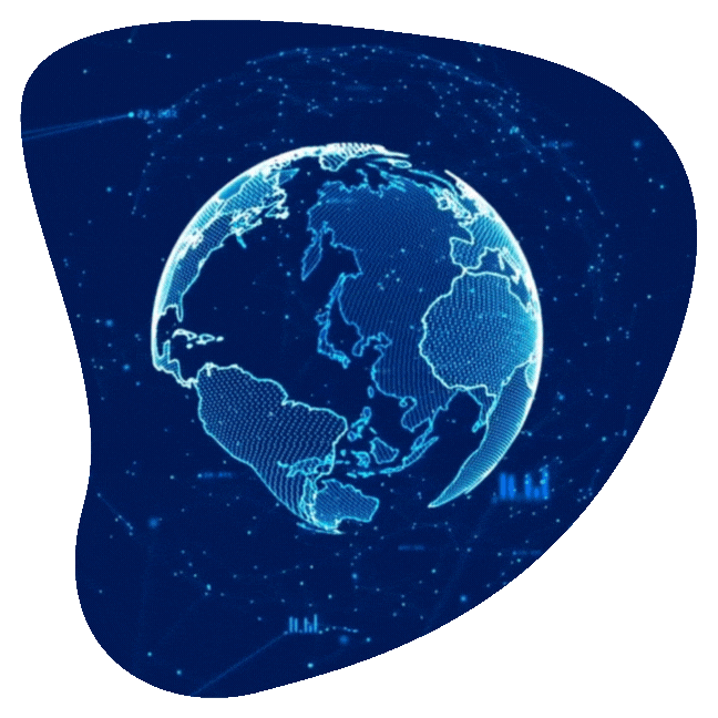
Turning Location Data into Actionable Insights
Geospatial data solutions involve the collection, analysis, and visualization of data tied to specific geographic locations. Sourced from satellites, GPS, sensors, and other technologies, this data is used to create maps, conduct spatial analysis, and uncover critical patterns that drive smarter decision-making.
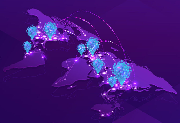
Why Geospatial Data Matters
✔ Enhanced Situational Awareness – Understand spatial relationships and trends to improve planning and resource allocation.
✔ Faster Emergency Response – Ensure aid reaches those in need quickly, reducing response times and maximizing impact.
✔ Smarter Decision-Making – Use data-driven insights to optimize strategies across various industries.
Key Applications of Geospatial Data:
- Urban Planning – Optimize infrastructure, land use, and community development.
- Environmental Monitoring – Track climate patterns, deforestation, and sustainability efforts.
- Disaster Management – Predict, prepare for, and respond to natural disasters more effectively.
- Transportation & Logistics – Improve route planning, fleet management, and operational efficiency.
By revealing spatial patterns and relationships, geospatial data empowers organizations to make informed, strategic decisions that drive efficiency, resilience, and sustainability.
Let us help you unlock the full potential of geospatial intelligence to shape a smarter future.
Did you know?
Suriname has its own geospatial data platform called Suriname Online GeoPortal. This platform consolidates geospatial data from both domestic and international sources into a single, unified system. It allows users to:
✔ Explore and download open geospatial data
✔ Discover and develop custom applications
✔ Address and solve key local challenges through data-driven insights
This powerful tool enhances decision-making across industries, supporting urban planning, environmental conservation, disaster management, and more.
Our Services
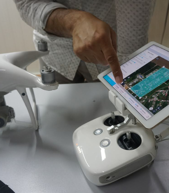
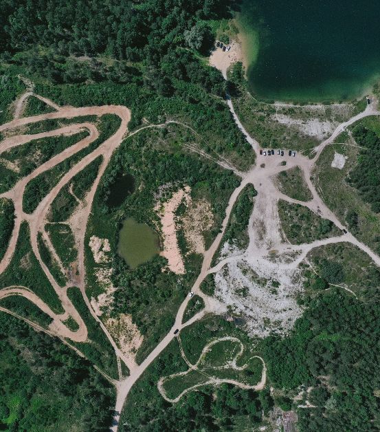
Drone Mapping
Harness the power of high-precision drone mapping to capture detailed aerial data, enhance survey accuracy, and optimize land and resource management.
Geo - Data Enrichment
Transform raw data into actionable insights with our Geo-Data Enrichment services. Unlock hidden patterns, enhance decision-making, and improve spatial analysis with enriched datasets.
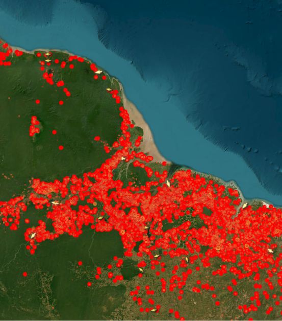
Satellite Imagery
Gain unparalleled clarity with high-definition satellite imagery—perfect for monitoring vast areas, tracking environmental changes, and conducting large-scale assessments with precision.
Drone Mapping
Precision. Efficiency. Innovation.
Unlock the power of high-precision aerial data with our advanced drone mapping services. Whether you’re in construction, agriculture, environmental monitoring, or any industry that relies on accurate geospatial data, we provide detailed insights to optimize your operations.
What is Drone Mapping?
Drone mapping utilizes unmanned aerial vehicles (UAVs) equipped with high-resolution cameras and sensors to capture detailed images and geospatial data from the air. These images are then processed using specialized software to generate:
✔ High-resolution maps
✔ 3D models
✔ Comprehensive geospatial insights
Why Choose Our Drone Mapping Services?
Unmatched Accuracy : Capture high-resolution images and data for precise mapping and informed decision-making.
Cost Efficiency: Reduce labor and equipment expenses while streamlining your workflow and saving time and money.
Enhanced Safety: Access hazardous or hard-to-reach areas without putting your team at risk.
Faster Data Collection :Drones cover large areas quickly and efficiently, delivering insights in real-time.
Leverage cutting-edge drone technology to make smarter, faster, and safer decisions for your projects. Let us help you map your future with precision.
Geo - Data Enrichment
Unlock the Full Potential of Your Data with Geographic Insights
Transform raw geographic data into powerful, actionable insights with our Geo-Data Enrichment services. Whether you use ArcGIS Online or other geospatial tools, we provide tailored solutions to fit your unique needs.
What is Geo-Data Enrichment?
Geo-Data Enrichment enhances existing datasets by integrating demographic, behavioral, and environmental data, providing deeper geographic context and valuable insights.
Using sources like GPS data, satellite imagery, and Esri’s GeoEnrichment service, we enrich location-based data with socioeconomic and demographic details, allowing organizations to see beyond raw numbers and uncover hidden patterns.
Why Geo-Data Enrichment Matters:
Improved Decision-Making: Gain location-specific insights to make more informed, strategic decisions.
Enhanced Targeting: Use precise geospatial data to refine marketing campaigns and business strategies.
Operational Efficiency: Optimize logistics and resource management with enriched geographic intelligence.
Risk Management: Anticipate and mitigate location-based risks to enhance safety and planning.
Leverage the Power of ArcGIS Online
By integrating Geo-Data Enrichment with ArcGIS Online, you can visualize patterns, predict trends, and make data-driven decisions with confidence.
Let us help you unlock the hidden value in your data—because every location tells a story.
Trainings offered
Leveraging ArcGIS Online: From Data to Dynamic Web Maps
Unlock the Power of ArcGIS Online in Just Three Days
Join our comprehensive three-day workshop designed to help you transform raw geospatial data into interactive, dynamic web maps using ArcGIS Online.
Who Should Attend?
Whether you’re a GIS professional, analyst, or enthusiast, this course equips you with the tools and knowledge to unlock the full potential of your spatial data.
No prior experience with ArcGIS Online is required—this workshop is ideal for beginners and those looking to enhance their web mapping skills.
What You’ll Learn:
- Creating & Publishing Web Maps – Learn how to design interactive maps for seamless data visualization.
- Spatial Analysis Techniques – Perform advanced location-based analytics to uncover insights.
- Cloud-Based Data Management – Securely store, organize, and share geospatial data.
- Optimized Workflows – Reduce human errors and improve internal and external client satisfaction through tailor-made information systems.
This training ensures optimal information flow, empowering you to make smarter, data-driven decisions with ArcGIS Online.
Transform the way you work with geospatial data—sign up today!
Satellite Imagery
See the World Like Never Before with High-Resolution Satellite Data
Harness the power of cutting-edge satellite imagery to gain unparalleled insights and make data-driven decisions in real time.
What is Satellite Imagery?
Satellite imagery consists of high-resolution images of Earth, captured by advanced sensors and cameras mounted on orbiting satellites. These images provide valuable geographic data for a wide range of applications, including:
Environmental Monitoring – Track deforestation, climate change, and ecosystem shifts.
Agriculture – Optimize crop health, soil conditions, and water usage.
Urban Planning – Assess infrastructure development, zoning, and expansion.
Disaster Management – Monitor natural disasters and support rapid response efforts.
Unlock the Full Potential of Satellite Technology
Through our partnership with Omeo Space, we provide high-resolution satellite imagery from over 90 satellites, ensuring:
Unmatched Image Quality: Access high-resolution imagery ranging from 30cm to 1m, delivering exceptional detail and clarity.
Frequent revisit times: Benefit from satellite revisit intervals as short as 15 minutes, keeping your data always up-to-date.
Real-time monitoring: Make informed decisions with timely and accurate geospatial data.
Enhanced decision-making: Gain deeper insights into geographic trends and spatial patterns, enhancing strategic planning and resource management.
Transform your operations with the most advanced satellite imaging solutions—because seeing more means knowing more.
Our Partners


Contact us!
Contact us today to learn more about how our services can help your organization thrive in the digital age.
Click the button below to provide your details, and we will reach out to schedule a meeting.